More Water Map Resources(Adapted from questions from GREEN (Global Rivers Environmental Education Network) and the Missouri Botanical Society) |
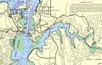
Topographic MapThis type of map may or may not overlap with the watershed map. Lines drawn closely together indicate a steep slope where water will run quickly. |
Point and Nonpoint Pollution SourcesThere may be a specialized map of your area showing these items, or you may need to look at several maps to assemble this information. • sewer overflow outlets |
Land Use Planning MapThis type of map shows the business, residential, and other major developed areas in communities. Things to look for include reservoirs, irrigation canals, and pumping stations. • Where are the major business, residential, industrial, and agricultural areas in your city? |
Drinking Water MapsA drinking water map shows the local wells, pipes, pipe sizes, manholes, and direction of water flow.
At town government, often a Health or Natural Resources department, should have these maps. Locate the well and well number closest to your school. • Where is water headed? |
Sewer MapsSewer maps indicate the flow of wastewater. All waste water flows in the direction of the waste treatment plant or to open water. Look for increasingly large pipes. Manholes are areas of access to the pipes for repair and for regulation of flow. • Is it going uphill or downhill? |
Return to Describing Your Water Return to Water Index |
 NOAA
NOAA